Where in the World?
The Islands of French Polynesia
These are the islands of French Polynesia that Mr. & Mrs. Brown will be exploring.
After exploring these island on Clipper Odyssey the expedition base will be on Moorea.
|
|
|
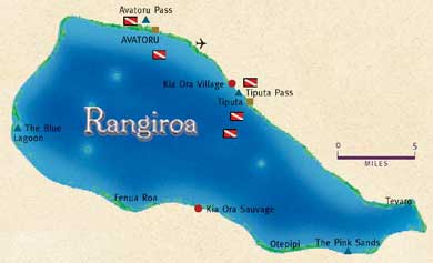
RANGIROA
• Land area: 16 square miles (40 square kilometers)
• Lagoon area: 393 sq mi (1,020 sq km) - 47 mi (75 km( long and 16 mi (25 km) wide
• Population: 1,913
|
 |
|
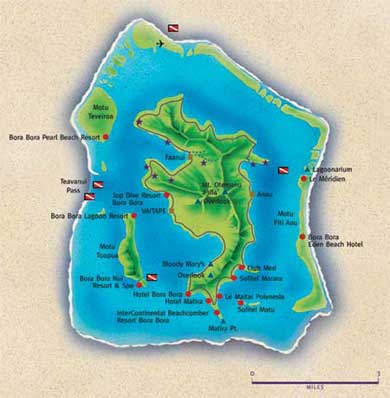
BORA BORA
• Size: 15 sq mi (38 sq km) - 5 miles ( 10 kilometers) long and 2 1/2 miles (4 km) wide
• Highest Point: Mt. Otemanu - 2,384 feet (727 meters) above sea level
• Population: 5,767
|
 |
|
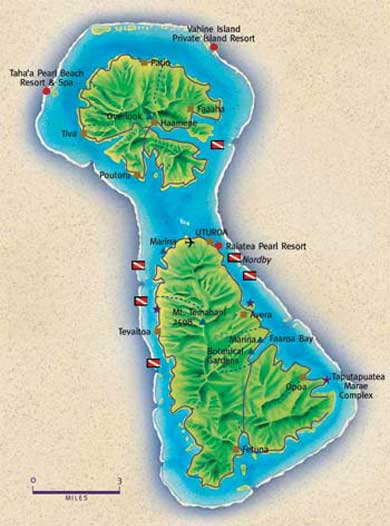
TAHAA
• Size : 34 sq mi (88 sq km)
• Highest Point: Mt. Ohiri - 1,961 ft (598 m) ASL
• Population: 4,470
RAIATEA
• Size : 105 sq mi (269 sq km)
• Highest Point: Mt. Tefatua - 3,336 ft (1,107 meters) ASL
• Population: 10, 057
|
 |
|
|
|
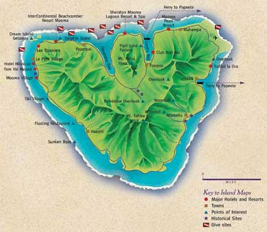
MOOREA
• Size: 53 sq mi (136 sq km)
• Highest Point: Mt. Tohiea - 3, 983 ft (1,207 m) ASL
• Population: 11,965
|
 |
|
|
|
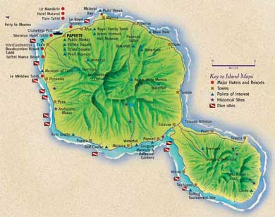
TAHITI
• Size: 402 sq mi (1,042 sq km)
• Highest Point: Mt. Ronui - 4,396 ft (1,332 m) ASL
• Population: 150,000
|
 |
|
|
|